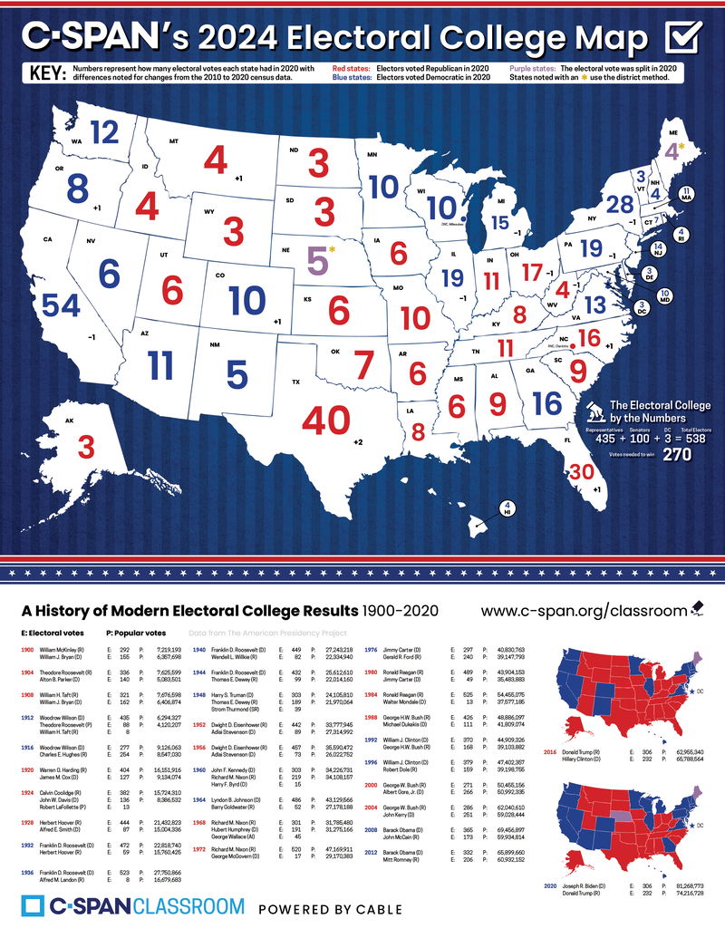
states are colored red & blue on this map based on the 2020 results
Here are my notes on teaching about voting (General Election, Nov 2024):
Wed Oct 23
explain early voting
Thu Oct 24
explain voting by mail

Mon Oct 28
read Leo's First Vote! by Christina Soontornvat
Tue Oct 29
read The Next President: The Unexpected Beginnings and Unwritten Future of America’s Presidents by Kate Messner
Wed Oct 30
read Grace for President by Kelly DiPucchio
(introduces Electoral College)
Thu Oct 31
tie US maps in with Letter Writing (look at postal abbreviations)
& play Election Night! game
(Electoral College map has been updated for 2024)


Mon Nov 4 - do more US map activities
& play Election Night! game again
- from Nienhuis Montessori:
Puzzle Map - The United States
United States Control Map (Labeled)
United States Control Map (Unlabeled)
United States Location Color Set
(includes 50 blank maps, color coding matches wooden puzzle)
Tue Nov 5 - convert blank US maps to electoral college maps, send home for students to color red/blue on Election Night
- FREE at TpT:
Blank US Map (with Alaska and Hawai'i to scale)
I've been looking for a map like this for a long time, and it was really fun to show it to the children. It has the sizes of each state to scale. It's amazing to see this and then remember that Alaska is only worth 3 votes! That's because Alaska has a very small population.
Your number of Electoral College votes is your number of Senators (everyone gets 2) + Representatives (this is based on population).
Blank US Map with States Labeled
This is the map we will use to create our Electoral College map.
Why Democracy Lives and Dies by Math
A documentary filmmaker and a mathematician discuss our fear of numbers and its civic costs.
The New York Times - Oct 24, 2024
This post contains affiliate links to materials I truly use for homeschooling. Qualifying purchases provide me with revenue. Thank you for your support!


 Immersive Experience
 Immersive Experience


No comments:
Post a Comment