I find it hard to process the information as it scrolls by so I'm copying and pasting some of the closest markers here, to help me plan our field trips:
Daniel Harmon Brush
On April 23, 1861, eleven days after Confederates fired on Fort Sumter, the cofounder of Carbondale, Daniel Harmon Brush, called a public meeting on this town square. Brush delivered a patriotic speech in support of the Union. Two days later, Brush stood atop his building on the southwest corner of Illinois Avenue and Main Street, waved the American flag, and dared Southern sympathizers to take it down. Brush’s two speeches during the opening days of the Civil War affirmed the region’s loyalty to the Union at a time when some in the area advocated secession or support of the South.
George Rogers Clark Campsite (3rd)
Lt. Col. Clark and his troop of 170 Virginians camped near here on July 2, 1778. It was their third campsite during a march from Fort Massac to Kaskaskia to capture that post from the British. Earlier that day, the troop was lost for a time on Phelp's Prairie. The next day, they would cross the Big Muddy River at Marshall's Ford. The Kaskaskia attack and a later one at Vincennes, Indiana, secured the Illinois Territory for the United States during the Revolutionary War.
First Coal Mine - Jackson County
The first coal mine in Illinois was located one-half mile south of here along the south bank of the Big Muddy River. William Boone and his indentured servant, a man name Peter, loaded a small raft with coal from an outcropping and, after floating down the Big Muddy and the Mississippi, they unloaded the coal in New Orleans on November 10, 1810. The coal was used for blacksmithing. In the next two years they repeated the venture six more times and others soon joined in the operation, including Joseph Duncan, a future governor of Illinois.
While there had been earlier sightings of coal along the Illinois River, historians credit Boone’s mine as the beginning of the industry in Illinois. Until 1823 Jackson County was the only county in Illinois to produce coal and all the mines were in the immediate area of Boone’s first mine. The mines were drift mines where coal was removed by tunneling into the banks along the river. During the first five years about one hundred tons were being mined annually.
Following the Civil War the mines along the Big Muddy were consolidated into the Grand Tower Manufacturing, Mining, and Transportation Company. Coal was transported by rail, which came to be called the “Granny Line,” to Grand Tower for the iron blast furnaces there and to supply fuel for the Mississippi River steam boats. The Big Muddy mine was the genesis of the mammoth coal industry in Illinois which brought prosperity and thousands of jobs to the state.
First Coal Mine in Illinois
The first coal mine in Illinois was located one-half mile south of here along the south bank of the Big Muddy River. William Boone and his indentured servant, a man name Peter, loaded a small raft with coal from an outcropping and, after floating down the Big Muddy and the Mississippi, they unloaded the coal in New Orleans on November 10, 1810. The coal was used for blacksmithing. In the next two years they repeated the venture six more times and others soon joined in the operation, including Joseph Duncan, a future governor of Illinois.
While there had been earlier sightings of coal along the Illinois River, historians credit Boone’s mine as the beginning of the industry in Illinois. Until 1823 Jackson County was the only county in Illinois to produce coal and all the mines were in the immediate area of Boone’s first mine. The mines were drift mines where coal was removed by tunneling into the banks along the river. During the first five years about one hundred tons were being mined annually.
Following the Civil War the mines along the Big Muddy were consolidated into the Grand Tower Manufacturing, Mining, and Transportation Company. Coal was transported by rail, which came to be called the “Granny Line,” to Grand Tower for the iron blast furnaces there and to supply fuel for the Mississippi River steam boats. The Big Muddy mine was the genesis of the mammoth coal industry in Illinois which brought prosperity and thousands of jobs to the state.
Jackson County, Illinois
On January 10, 1816, Jackson County, created from Randolph and Johnson counties became Illinois’ ninth county. It was named for General (later president) Andrew Jackson, hero of the Battle of New Orleans. The county’s first seat, Brownsville, was established on land donated by Conrad Will and was once Illinois’ third largest town.
In 1836, Benningsen Boon vs Juliet, one of the first court cases arguing against African-American indentured servitude in Illinois, was heard in Brownsville and later settled by the Illinois Supreme Court.
The original Jackson courthouse burned in January 1843, and citizens voted to relocate the county seat to land donated by Dr. John Logan, father of General “Black Jack” Logan. The newly minted town of Murphysboro officially became the county seat in September of 1843.
Dr. John Logan
Dr. John Logan, born in Ireland in 1788, came to America with his family in 1793. He moved to Jackson County in 1822 where he married Elizabeth Jenkins. Dr. Logan served four terms in the Illinois Legislature and became a friend of Abraham Lincoln. In 1839, Lincoln suggested that Logan County be named in his honor. In 1843, Dr. Logan gave land for Murphysboro and soon built the Logan House hotel on this site. He died here in 1853. At his death his son, John A. Logan, was serving his first term in the Illinois General Assembly.
Elizabeth Jenkins Logan
Elizabeth Jenkins, born in 1803 in North Carolina, married Dr. John Logan in 1825. When her son, John A. Logan, joined the Union army in 1861, Elizabeth refused to speak to him. In this, she reflected the strong southern feelings held across Egypt, as Southern Illinois was called. In 1867, Elizabeth founded a congregation of the Southern Methodist Church in Murphysboro. By 1870, mother and son had reconciled. Elizabeth Logan died in her home, located at this site in 1874. Her son, Thomas M. Logan, was a founder of the First Bank and Trust Company of Murphysboro, which now occupies this location.
Major General John A. Logan
John A. Logan was born here in 1826. He fought in the Battle of Bull Run as a Democratic Congressman. Logan joined the Union Army and before the Civil War's end he earned the rank of Major General. Experiences in the war changed Logan from a supporter of slavery to a champion of equal rights for African Americans. After the Civil War Logan returned to Congress as a Republican. He served three terms in the U.S. Senate and was a Republican Vice-Presidential candidate in 1884. Logan died in Washington, D.C. in 1886. His greatest legacy is the creation of Memorial Day as a national holiday.
George Rogers Clark Campsite (4th)
In the third year of the American War for Independence, Lt. Col. George Rogers Clark and his army of 170 Virginia volunteers camped five miles southeast of here. On July 2, 1778, Clark made the fourth of five camps on his march from Fort Massac to Kaskaskia. Two days later, Clark liberated Kaskaskia, and then moved east to Vincennes, thus securing the Illinois Territory from the British and their Indian allies.
Lincoln-Douglas Debate
On September 15, 1858, in the midst of the senatorial campaign of that year, Abraham Lincoln and Stephen A. Douglas met at Jonesboro in the third of the famous series of debates which made Lincoln a national figure. The debate was held in a grove one quarter-mile to the north.
George Rogers Clark Campsite (2nd)
This marker commemorates the July 1, 1778, campsite for Lt. Col. Clark's troop of 170 volunteers. At the time, the site had a nearby spring and was north of a place called Buffalo Gap. The men were marching from Fort Massac to capture the British post at Kaskaskia. This attack and a later one at Vincennes, Indiana, prevented the British and their Indian allies from invading Kentucky. It also secured the Illinois Territory for the United States during the Revolutionary War.
Anna-Jonesboro - Trail of Tears Site - Lincoln-Douglas Debate
Union County was created January 2, 1818, when Illinois was still a territory. County commissioners established Jonesboro as the county seat on land donated by John and Juliet Grammer.
During the frigid winter of January 1839, thousands of Cherokee, enroute from Georgia to Indian Territory in Oklahoma, camped near here along Dutch Creek, unable to cross the Mississippi due to floating ice. Nearly 2000 of the 13,000 who began the “Trail of Tears” died during the journey.
In the 1850s the Illinois Central Railroad planned to run tracks through this area. Jonesboro was asked to have a survey made at a cost of $50. When the town failed to meet this requirement, Winstead Davie submitted a survey routing the railroad through his property east of Jonesboro. A town was platted in 1854 along the tracks and Davie named it “Anna” in honor of his wife, Anna Willard Davie.
On September 15, 1858, the third Lincoln-Douglas debate was held north of the Jonesboro square. Lincoln was a guest of D.L. Phillips at 511 S. Main in Anna. The debate was attended by less than 1500 people – the smallest crowd of the series.
During the Civil War, Anna served as one of the rendezvous points in Illinois for troops. Eight Union regiments were assembled here. General Grant spent one week in Anna mustering in troops. In 1869 the Southern Illinois Hospital for the Insane – now the Choate Mental Health Center – was built in Anna.
Home of John A. and Mary Logan, 1856-1861
John A. Logan 1826-1886, U.S. Representative 1859-1862, 1867-1871; Civil War General, 1861-1865; U.S. Senator, 1871-1877, 1879-1886; Vice presidential Candidate with James Blaine 1884. He established Memorial Day as a National holiday on 1868. John A. Logan and Mary Cunningham were married in Shawneetown on November 27, 1855, and then moved to Benton where John practiced law. They lived in a small frame house on this site. Mary moved to Carbondale in 1861 where she remained during the Civil War.
Carrier Mills Archeological District
This area of some 143 acres located approximately two miles south of Carrier Mills was inhabited by prehistoric people throughout three different archaeological periods. Until the turn of the century, the South Fork of the Saline River was a meandering stream with large area of swamps and shallow cypress lakes nearby. These areas were rich in plants and animals that prehistoric inhabitants sought for food. Therefore, the locality became a natural focal point for human settlement. In 1978 and 1979, archaeologists intensively investigated this area. Excellent preservation conditions permitted the recovery of many tools and animal and plant remains that have provided significant new insights into the prehistory of southern Illinois.
Sporadic use of the area by small groups of hunters and gatherers can be dated to 8000 B.C., and the area was used more or less continuously until 1400 A.D. Settlement activity increased dramatically during the late Middle Archaic Period, 4500 to 3000 B.C., when the area was inhabited by larger groups with a more sedentary lifestyle. These occupations produced thick deposits containing many artifacts and burials. The area also saw heavy use during the Middle and Late Woodland periods, 200 B.C. to 900 A.D. The peoples of those times increasingly emphasized the collection and storage of plant foods and began to domesticate some native plants. The final prehistoric inhabitants were Mississippian Period Indians. (900 to 1400 A.D.), who lived in scattered farmsteads and cultivated corn and squash.
George Rogers Clark Campsite (1st)
Lt. Col. George Rogers Clark and his troop of 170 volunteers, principally Virginians, camped near this site, called Indian Point, on June 30, 1778. They were marching from Fort Massac to attack the British post at Kaskaskia. This was the first of five campsites on that march. Clark's men would take the post at Kaskaskia and, later, the British fort at Vincennes, Indiana. This work helped secure the Illinois Territory for the United States during the Revolutionary War.
The Tobacco Industry
From the creation of Saline County in 1847 to the end of the century the production of tobacco was the principal industry. In 1870 Saline County had the highest tobacco production in the state. The Webber Brothers of Galatia and Raleigh were the largest buyers and processors in the county, some years exporting 1,500,000 pounds of tobacco.
Chester-Kaskaskia, Illinois
Shadrach Bond, first Governor of Illinois (1818-1822), is buried in Evergreen Cemetery in Chester. The first recorded settler in the area was John McFerron who purchased land in 1817 but Samuel Smith, who settled here in 1830, is considered the founder of Chester. Formerly known as Smith's Landing, the community was renamed after Chester, England. The town was a river port for the export of such local products as castor oil, flour, and meat during the mid-nineteenth century. It became the county seat in 1848 and was incorporated as a city in 1855.
Kaskaskia, founded in 1703 as a Jesuit mission, became a prominent French village. During the French and Indian War (1754-1763) between France and Britain, Fort Kaskaskia was erected on the bluffs near the settlement. By the Treaty of Paris in 1763, Kaskaskia came under British control. On July 4, 1778 George Rogers Clark captured Kaskaskia settlement and the area became part of Virginia. Kaskaskia served as Illinois Territorial Capitol (1809-1818) and as the first state capitol (1818-1820). When the capitol was moved to Vandalia, Kaskaskia declined in importance. Mississippi floods from 1844 to 1910 gradually destroyed the old settlement, and the area is now Fort Kaskaskia State Park.
Sites of interest include the Garrison Hill Cemetery containing a monument to the pioneers; the home of Pierre Menard, first Lieutenant Governor, which is preserved as a State Memorial; and the Kaskaskia State Memorial on Kaskaskia Island containing the "Liberty Bell of the West."
George Rogers Clark Campsite, 5th
In the third year of the American Revolutionary War, Lt. Col. George Rogers Clark and his army of 170 Virginians set out from Fort Massac (Metropolis) on their way to liberate the town of Kaskaskia from British control. On July 3, 1778, Clark's army crossed the old state road near Welge and established its fifth and final camp on the west side of St. Mary's River.
On July 4, Clark's army marched to a staging point at Diamond Cross and later that evening attacked and secured Kaskaskia.
Kaskaskia
From 1703 until it was washed away by the Mississippi two centuries later, the ancient town of Kaskaskia - the second settlement in Illinois, the territorial capital and the first state capital - stood two miles southwest of here. Fort Kaskaskia State Park and the Menard Home are memorial to this once prominent village.
Charter Oak School
Charter Oak School is said to be the only octagonal one-room brick schoolhouse in Illinois. It was built in 1873, in accordance with a design suggested by Daniel Ling, a teacher of the Charter Oak School District. It served as a school until 1953. The octagonal shape utilizes daylight and offers wind resistance. The first school in the district was a log building, erected three years after the Illinois Free School Law was passed in 1845. This was succeeded in 1863 by a frame structure, in which Ling taught in 1872-1873.
Appellate Courthouse
This building was constructed for the Southern Division of the Illinois Supreme Court, one of three Divisions created by the Constitution of 1848. Court met in lodge halls in Mount Vernon prior to completion of the center section of this building about 1857. The 1870 Constitution established a system of Appellate Courts and Mount Vernon was named the seat of the Fourth District. The Supreme Court shared the building until 1897, after which all of its sessions were held in Springfield.
The Marine Ways
During the Civil War the naval depot of the western river fleet was located at Mound City. Here the keels of three of the famous Eads ironclad gunboats were laid, and a large force of workmen were employed to keep the fleet in fighting trim. The marine ways, still in operation, are 400 yards south of here.
The American Bottom
The American Bottom is that sixty mile long strip of lowland lying between the bluffs and the east bank of the Mississippi River. Its earliest recorded history is written in the annals of France, England, and Spain. In the wars, these nations fought against each other and against native Indian tribes for dominion of the New World.
Following the discoveries of Jolliet and Marquette in 1673 and exploration of LaSalle in 1682, France claimed possession of the entire Mississippi Valley. Extending from the Appalachian Mountains in the East and the Spanish Empire in the West, here in the center of this vast expanse known as the Illinois Country, Louis XIV erected a fort and settlers from Canada and France established the village of Cahokia in 1699 and the villages of St. Philippe, Fort de Chartres, Prairie du Rocher, and Kaskaskia early in the eighteenth century.
During England’s occupation of the Illinois Country, 1765-1778, she retained the American Bottom as the center of administration for the area renamed the Illinois Province of Quebec. Virginia, likewise, established the American Bottom as headquarters for her Illinois County, 1778-1781, when George Rogers Clark drove the British from the area.
The American Bottom part of the Old Northwest Territory gained recognition under the government of the United States by being named the site of the first county established in Illinois in 1790, the capital of the Illinois Territory, 1809-1818, and the home of the first state capital.

 Immersive Experience
 Immersive Experience
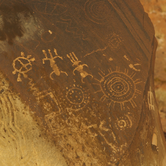 Immersive Experience


No comments:
Post a Comment